 |
|
In this demonstration, the Pacific Oceanic Plate is moving
northwest and fixed
hotspot is creating islands.
|
Hawaii in 1000 years:
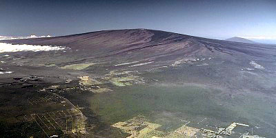
In 1000 years from now, Hawaii will be close to the same as it is today. In geography years, 1000 years is pretty much nothing. But due to the increased amount of UV rays from the sun because of the ozone layers depletion, will increase the annual average temperature of Hawaii from about 75 degrees (today) to about the mid 80s. Hawaii (hypothesis made from data gathered by the National Climatic Data Center). Also, Hawaii will expeience a volcanic eruption by the considered most active volcano, Kīlauea, on the Big Island of Hawaii.
 |
|
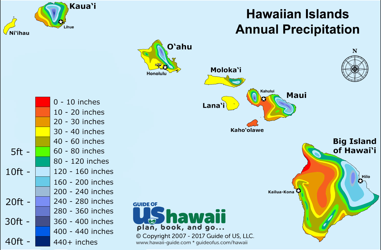
Hawaii
has 8 Islands, which are Niihau, Kauai, Molokai, Lanai, Kahoolawe, and the Big
Island Hawaii. Refer to the hand drawn map above. The red dots on the map
indicate active volcanos today.
|
Hawaii in 10,000 years:
In ten thousand years Hawaii will
not change all too much compared to it one thousand years from now. Although
the islands of Kauai, Niihau, Oahu, and Molokai will start to be submerged in
the Pacific Ocean due to mass wasting on the islands and sea level rising due
to glaciers melting. But something is also brewing underneath the seas of
Hawaii something huge that in thousands of years could change the look of
Hawaii forever. This object brewing on the Hawaiian Hot Spot is a super volcano
capable of creating another island just south east of the big island of Hawaii.

Refer
to the above for a hand drawn picture of Hawaii in 10,000 years. The red
indicates active volcanos.
In a million years Hawaii will
look completely different from the way it is today. The islands Kauai, Niihau,
Oahu, and Molokai will not be above water anymore. Researchers found that the
mountains located on Oahu (Koolau and Waianae), are being destroyed by erosion
because the water under the island are dissolving it from the inside! So with
this evidence and the fact that many ice glaciers are melting (which will raise
the water levels on earth), Hawaii will lose four of its islands. But in a
million years, Hawaii will also gain an island. The volcano, Loihi, will erupt
and become very active . This is how the other islands were formed and history
always repeats itself.

This
is drawing of Hawaii in islands in 1 million years. The red triangles indicate
active volcanos in Hawaii.
All in all there is much
knowledge we’ve have gained from this final blog about the ways Hawaii could
shape out to look like in the future. It first starts with the 1,000 year mark where
we learned that the only major change is in the ozone with more UV rays getting
through ultimately affecting the islands temperature (as much as a 5 degree
difference). Next we fast forward to 10,000 where we see mass wasting and sea
levels rising, mostly affecting the islands of Kauai, Niihau, Oahu, and Molokai.
Finally in one million years from now Hawaii (according to our hypothesis) will
take on a whole different look. With the islands of Kauai, Niihau, Oahu, and
Molokai all under the Pacific Ocean, Hawaii will have a new island appearing
south east of the big island of Hawaii. This causes by a volcanic eruption of a
super volcano sitting under the water and on the Hawaiian Hot Spot.
Sources:


